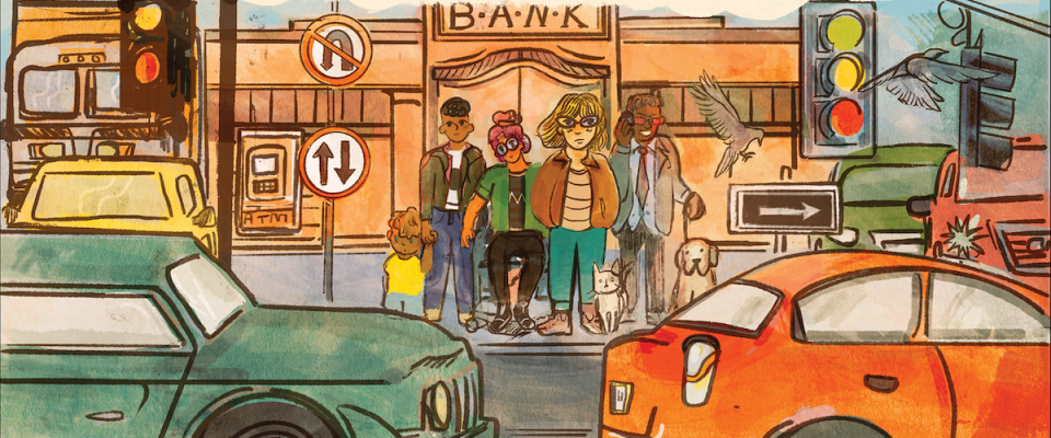
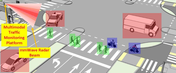
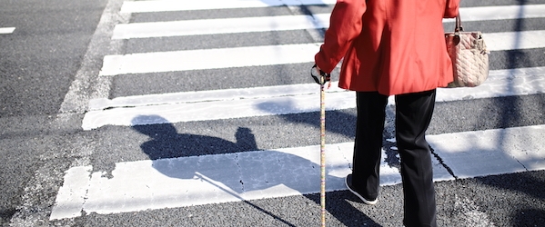
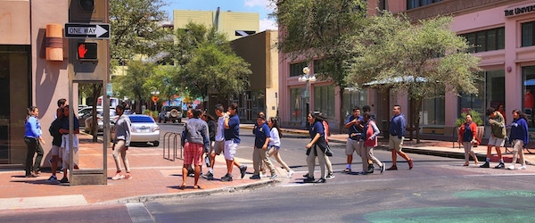
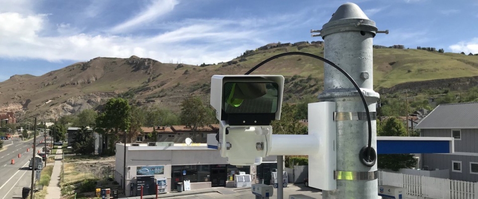
Pedestrian safety is critical to improving walkability in cities. To that end, NITC researchers have developed a system for collecting pedestrian behavior data using LiDAR sensors. Tested at two intersections in Texas and soon to be tested at another in Salt Lake City, Utah, the new software created by a multi-university research team is able to reliably observe pedestrian behavior and can help reduce conflicts between pedestrians and vehicles at signalized intersections. The Utah Department of Transportation (UDOT) is already working on implementing this new system to improve data collection at intersections.

Learn more in a free webinar May 18. 

The LiDAR system can especially improve multimodal travel at intersections with permissive left turns, which are indicated by a flashing yellow arrow. Previous research has shown that where a flashing yellow arrow, or FYA, is present, cars searching for a gap in traffic may not look for pedestrians. To remove the risk to people walking, some signals are programmed to turn off the FYA when a walk button is pushed. But...

Read more

A new transportation comic, "Moving From Cars To People (PDF)," offers a succinct and fun introduction to a complicated topic: namely, how the built environment in the United States came to be designed for cars and what we can do about it.

Want a physical copy? Here are a few ways to get one:

Read more

Navigating an unfamiliar place is uniquely challenging for people with disabilities. People with blindness, deafblindness, visual impairment or low vision, as well as those who use wheelchairs, can travel more independently in urban areas with the aid of effective wayfinding technology. A new report from the National Institute for Transportation and Communities (NITC) explores how to leverage low-cost methods to enable people to more easily move through public, urban indoor and outdoor spaces.

The study, led by Martin Swobodzinski and Amy Parker of Portland State University, used focus groups, two case studies, and an in-person structured wayfinding experience on the PSU campus to find the most helpful ways of getting around. Tactile maps were found to be a very useful resource, with an accessible mobile app also showing promise as an orientation and mobility aid.

The researcher will share more details about this project in a free webinar on December 15: Individual Wayfinding in the Context of Visual Impairment, Blindness, and Deafblindness.

WHY IS THIS RESEARCH IMPORTANT?

Environments and...

Read more

Intelligent Transportation Systems (ITS) need traffic data to run smoothly. At intersections, where there is the greatest potential for conflicts between road users, being able to reliably and intelligently monitor the different modes of traffic is crucial.

The Federal Highway Administration (FHWA) estimates that more than 50 percent of the combined total of fatal and injury crashes occur at or near intersections. For pedestrians the intersection is a particularly dangerous place: the City of Portland, Oregon identified that two-thirds of all crashes involving a pedestrian happen at intersections. And when darkness comes earlier in fall and winter, crashes increase dramatically. So knowing what's going on in low-visibility conditions is essential for mobility and safety of all road users.

Some agencies use cameras to monitor traffic modes, but cameras are limited in rainy, dark or foggy conditions. Some cities use radar instead of cameras, which works better in low-visibility but typically can't provide as rich a picture of what's going on. Conventional radar gives movement and position data for all...

Read more

As we get older, transportation provides a vital link between home and community. Without reliable and easy ways to get around, many older adults (especially those who live alone) have limited access to essentials like groceries and medicine, let alone social interaction. A new report from the University of Texas at Arlington (UTA), Developing Strategies To Enhance Mobility And Accessibility For Community-Dwelling Older Adults, looked at the mobility challenges, barriers, and gaps that older adults experience, with an eye toward developing forms of assistance or educational strategies to fill those gaps.

Funded by the National Institute for Transportation and Communities (NITC) with additional support from The Senior Source, the interdisciplinary research team from the University of Texas at Arlington included Kate Hyun, Caroline Krejci and ...

Read more

How can we use a variety of data-driven speed management strategies to make transportation safer and more efficient for all modes–whether you’re driving, walking or taking transit?

The project was led by Yao Jan Wu, director of the Smart Transportation Lab at the University of Arizona. Co-investigators were Xianfeng Terry Yang of the University of Utah, who researches traffic operations and modeling along with connected automated vehicles, and Sirisha Kothuri of Portland State University, whose research has focused on improving signal timing to better serve pedestrians. Join them on Sept 15, 2021 for a free webinar to learn more.

"We want to improve mobility for all users, be it pedestrians, vehicle drivers or transit riders, and there are different strategies to do this. How do we harness data to drive us to these strategies?" Kothuri said.

Funded by the National Institute for Transportation and Communities (NITC), this multi-university collaboration addressed the question from three angles:

  • Wu and his students in Arizona looked at the impact of speed management strategies on conventional roadways...
Read more
Rethinking Streets for Physical Distancing, the third in our "Rethinking Streets" book series, has been released. The book offers 25 case studies from a broad swath of U.S. cities with a handful of international examples of streets that were redesigned to better accommodate people during the COVID-19 pandemic. Rethinking Streets is a design guidebook series produced by NITC researchers at the University of Oregon, led by Marc Schlossberg. The three books are:

These full-color design guides have proven popular with planners and...

Read more
Salt Lake City overview on a sunny day
Photo by AndreyKrav
Reid Ewing, University of Utah

 A "polycentric" region is a network of compact developments (centers) that are connected with each other through high-quality transportation options. As the antidote to sprawling suburbs, compact centers can encourage all the things that sprawl discourages: public health, environmental sustainability, social cohesion, and economic diversity. But how can metropolitan planning organizations ensure that...

Read more
Street icons for bicycle and pedestrian
Photo by Cait McCusker
Nathan McNeil, Portland State University; Kristin Tufte, Portland State University

In the past decade bike and pedestrian count programs have sprung up all over the United States, gathering data to evaluate biking and walking infrastructure. However, these modes have not been studied with the quantitative rigor applied to motor vehicle travel. A research project funded by the National Institute for Transportation and Communities (NITC), led by Nathan McNeil of Portland State University (PSU), offers a method for monitoring the quality of this bike-ped count data.

... Read more
Principal InvestigatorIvis Garcia, University of Utah
Learn more about this research by viewing the related presentations and the full Final Report on the Project Overview page.

Students in the University of Utah’s Westside Studio investigated how to improve access to downtown from the west side of Salt Lake City.

Led by Ivis Garcia, the project's goal was to learn from residents about their use of an existing multi-use path, the Jordan Park River Trail, and to help enhance the connection between residents living near the trail and the downtown area on the river's east side.

Students surveyed 300 residents and conducted focus groups, which revealed that many area residents either didn't know about the trail or didn't perceive it as a safe place to walk. Local community leaders also visited the class and shared their expertise with students.

"A lot of elements of the course were around teaching community engagement and action," Garcia said.

In order to enhance users...

Read more

Pages