
Travel behavior and land use are interconnected. In academic research, travel itself is often treated as a demand derived from the activities for which it serves. In practice, coordinating and linking transportation and land use decision-making proves to be challenging. Download the full literature review of NITC research in transportation and land use here, or you can download our two-page summary here.
In a series of NITC Research Roadmaps, we surveyed a decade of contributions across six areas of transportation research funded by the National Institute for Transportation and Communities (NITC).
Travel Behavior, Land Use Patterns, and External Impacts
NITC research has helped to unpack the influences of the built environment on travel behavior. A series of studies investigating trip generation rates found that the Institute of Transportation Engineering Trip Generation Handbook vastly overestimates vehicle demand, and developed alternative methods to estimate pedestrian trips in urban environments. Other NITC studies have improved our understanding of how transit-oriented development (TOD) can improve transit access, increase multimodal travel, and decrease transportation costs associated with vehicle ownership and use. Over time, TOD neighborhoods encourage residents to walk and take transit more while driving less.
We have improved our understanding about the travel behavior of people living and working in dense urban centers. A study of 70+ retail and service locations observed higher rates of multimodal travelers than previously expected by industry standards. Having this qualitative information has made it easier for practitioners to predict the outcomes of new developments, and to meet goals on reducing greenhouse gas emissions, decreasing automobile traffic congestion, and improving air quality and overall public health.
Transportation, Jobs/Housing, and Property Value
Economic vitality is a primary goal that practitioners consider when evaluating transportation and land use plans. A series of NITC studies explored the contribution of transit investments – particularly fixed-guideway transit systems – on real estate values, as well as employer and household location changes. Quality transit investments see higher rates of adjacent development within walking distance to the station, and often corresponding increases in land value. This indicates a vast latent demand for high-quality, TOD’s in U.S. metropolitan areas. This study also offers a robust data repository, publicly accessible, containing demographic data for workers and longitudinal employment data in relation to 52 transit systems in 35 metro areas across the country.
Other NITC work has focused on the relationship between bike accessibility and economic measures, such as business vitality and property values. Higher bike accessibility ratings were associated with higher residential – especially multifamily – property values, as well as office, retail, services, and park employment. Significant attention has been placed on how to consider the social equity impacts of bike infrastructure, including the impact of new plans on historically marginalized communities.
Attitudes, Preferences, Choices, and Decision-Making
Attitudes and preferences for characteristics of travel, households, and neighborhoods play a powerful, but less understood, role in understanding how different strategies and programs might increase access to destinations, lower transportation costs, and improve quality of life. NITC has contributed several studies that explore market response to programs and strategies targeting improved access to services. One study evaluated whether a pilot transportation demand management program in Portland, Oregon improved mobility by providing a suite of discounted transportation services to low-income participants. More than half of the participants tried new transportation modes they had not used before, including bike share, transit and ride-hailing.
Other NITC work recommends evaluating transportation options before residential (or workplace) location choices are made. One study evaluated residential location preferences and found a dissonance between stated preferences and location choices; in that residents often say they prefer more dense, urban neighborhoods than they actually do move to. This indicates a latent demand for more multimodal and accessible neighborhoods.
Housing and Transportation Affordability and Vulnerable Communities
Increases in land value are often a result of increased competition for limited supply, and rising rents and property values can displace vulnerable households. While transportation infrastructure investments may aim to improve multimodal access to opportunities, they could be adding pressures to the very communities they sought to help. NITC research offers strategies to address this, including the recommendation that the U.S. Department of Housing and Urban Development’s direct subsidies to more compact, walkable, and transit-oriented neighborhoods.
National-scale performance metrics are incredibly valuable, but not without limitations. Several NITC studies have demonstrated the value of locally driven data and analysis that can better identify neighborhoods' and households' needs. While multimodal investments can improve location efficiency and affordability, successful implementation requires localized analysis and meaningful public participation to achieve results that benefit all members of the community.
Our work has focused on vulnerable populations and the nuanced ways in which different people experience environments differently. These have included environmental justice populations within fast-growing suburban "boom towns;" refugee and immigrant communities in Texas and Arizona; people experiencing homelessless who access social services; and former inmates returning to society.
Integrated T&LU Planning and Evaluating Trade-Offs
Transportation and land use regulation and governance tend to be tied to different political jurisdictions, complicating the ability for local and regional practitioners to think about travel and land use in an integrated and complementary manner. NITC researchers have explored a variety of strategies to better synchronize transportation and land use planning. For example, rural towns and places with high natural amenity value are currently experiencing “big city problems” like rapid increases in population growth and tourism, low wages, lack of affordable housing, and income inequality. A series of NITC studies has focused on assessing challenges specific to these "Gateway and Natural Amenity Region Communities (GNAR)” to support stakeholders in effectively studying these areas to a degree that reflects their regional importance.
Conclusion
In order to move forward with more coordinated transportation and land use practice, it is essential that we identify, understand, and communicate the trade-offs on a wide range of goals and outcomes. The research summarized in this roadmap has taken steps toward achieving a variety of measurable outcomes that are sensitive to the implications for different populations, as well as producing evaluation and communication tools that can help facilitate discussions on these trade-offs as they correspond with both transportation and land use decisions.
What are the impacts and key findings of our research at the nexus of transportation, land use and housing, and the economic value of investing in multimodal infrastructure? Learn more about some impact stories below.
 Traditionally the discussion about affordability has focused on housing. In late 2013, the Department of Housing and Urban Development (HUD) launched the Location Affordability Index (LAI) Portal - a dataset that uses models to estimate the median amount households spend on housing as well as transportation. The tool is meant to help people understand the combined costs of housing and transportation, and affordability, associated with living in a specific neighborhood. However, there was virtually no validation of the estimates in any setting, and no studies delving into how accurate the estimates are in the context of “shrinking” or weak-market cities.
 Dr. Kelly Clifton
 This body of work represents the culmination of nearly a decade of research into the economic effects of transit: looking at 17 light rail transit (LRT), 14 bus rapid transit (BRT), 9 streetcar transit (SCT), and 12 commuter rail transit (CRT) systems in 35 metro areas across the United States. A surprising finding from this analysis was that transit systems vary substantially in their attractiveness to jobs with respect to place typology. A second surprising finding: while one might assume that higher wage jobs would be more attracted to transit stations than middle or lower wage jobs, this is not necessarily the case. Analysis revealed important contextual differences for each transit mode with regards to workers' wage group and distance.
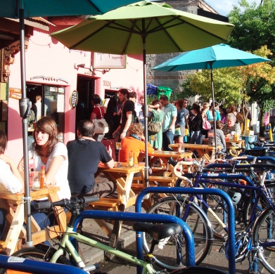 This study related consumer behavior – the frequency of visits to a business establishment and the amount spent per trip – to patrons’ mode choices. The research team conducted intercept surveys on how customers arrived and how much they spent at 78 restaurants, bars and convenience stores throughout the Portland region. They found that only 43% of bar patrons, 63% of restaurant customers and 58% of convenience store shoppers drove — the rest took transit, biked, or walked. Those results surprised Clifton. “I didn’t expect a mode share for non-auto trips to be so high. In one auto-oriented community it was 40%.” Findings revealed important differences in spending and frequency by mode for different business types; however, when taken over the course of the month, spending was generally not significantly different by mode. Drivers did tend to spend more per trip, Clifton and her colleagues found, but they also shopped less often. The two effects basically canceled each other out. “People who walk and take transit are competitive consumers,” she says. One Portland-area convenience store chain was so struck by the study’s findings that it installed new bike racks outside its locations. This offers encouraging news for cities and local businesses as they strive to attain their sustainability goals through the encouragement of non-automobile modes.
