The video begins at 2:55.

With the advent of the alternative fuels, it’s very appropriate that gasoline is based on fossil fuels and becoming ancient history. As the gas tax becomes less and less pertinent to adequately funding infrastructure, electronic cashless non-stop tolling options are a more viable solution to financing new projects and providing mobility to existing infrastructure. There are a number of technologies being evaluated for the future; including global position systems (GPS), existing proprietary radio frequency (RF) systems, open standard dedicated open standard dedicated short range communications (DSRC) systems, or the existing cellular networks are also being considered. This presentation will focus on what technologies are available and what emerging technologies are the most likely to emerge as an effective and affordable approach to funding user fees and infrastructure needs. This presentation will also describe how user fees and tolling systems can help the environment, reduce congestion, and provide effective cashless transportation systems based on equitable user fees.

View slides

If you would like to receive continuing education credits such as PDH or CM, please make sure to complete this evaluation form once you've watched the entire video so that we have a record of your attendance.

Watch video:

Webinar: States on the Hot Seat

Transportation accounts for approximately 33 percent of greenhouse...

Read more

The video begins at 1:49.

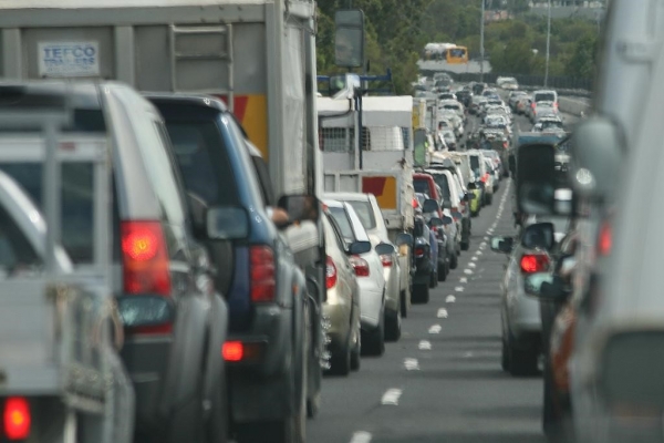
Abstract: Policy-makers, researchers, and activists often assume that traffic congestion mitigation results in reduced motor vehicle emissions without proper justification or quantification. This research investigates under which conditions that assumption is valid by comparing trade-offs between increased efficiency and induced travel. Analyses include investigation of varying vehicle fleets - including advanced-drivetrain vehicles. Results demonstrate that higher levels of congestion do not necessarily increase emissions, nor will congestion mitigation inevitably reduce emissions. These results apply for both roadway capacity expansions and traffic flow improvement projects. We compare the emissions effects of various congestion and emissions mitigation strategies, with particular attention to the roll of trucks and the potential of truck-only facilities. Congestion performance measures are also compared for applicability to emissions trends.

View slides

Watch video:

Smart Cities: Improving the Roadside Environment with Distributed Sensor Systems

The City of Portland is exploring how distributed “Internet of Things” (IoT) sensor systems can be used to improve the available data that is usable by city engineers, planners, and the public to help inform transportation operations, enable assessments of public health and equity, advance Portland’s Climate Action Plan goals, and...

Read more

View slides

The video begins at 2:46.

Promising Greenhouse Gas Emissions Reduction Strategies for the Transportation Sector: Low Carbon Fuels, Leveraging Transit with Smart Growth, and Ports and Goods Movement Opportunities

Watch video

View slides: Bell Presentation (PDF)

Moore Presentation (PDF)

Ma Presentation (PDF)

Summaries: 
Identification and Characterization of PM2.5 and VOC Hot Spots on Arterial Corridor by Integrating Probe Vehicle, Traffic, and Land Use Data: The purpose of this study is to explore the use of integrated probe vehicle, traffic and land use data to identify and characterize fine particulate matter (PM2.5) and volatile organic compound (VOC) hot spot locations on urban arterial corridors. An emission hot spot is defined as a fixed location along a corridor in which the mean pollutant concentrations are consistently above the 85th percentile of pollutant concentrations when considering all other locations along the corridor during the same time period. In order to collect data for this study, an electric vehicle was equipped with instruments designed to measure PM2.5 and VOC concentrations. Second-by-second measurements were performed for each pollutant from both the right and left sides of the vehicle. Detailed meteorological, traffic and land use data is also...

Read more

No archived materials are available for this presentation.

Watch video

View slides

Summary: Since about 2008, the planning world has been experiencing a paradigm shift that began in places like California and Oregon that have adopted legislation requiring the linking of land use and transportation plans to outcomes, specifically to the reduction of greenhouse gases (GHGs). In response to this need, Calthorpe Associates has developed a new planning tool, called UrbanFootprint, on a fully Open Source platform (i.e. Ubuntu Linux, PostGIS, PostGreSQL, etc.). As a powerful and dynamic web and mobile-enabled geo-spatial scenario creation and modeling tool with full co-benefits analysis capacity, UrbanFootprint has great utility for urban planning and research at multiple scales, from general plans, to project assessments, to regional and state-wide scenario development and analysis. Scenario outcomes measurement modules include: a powerful ‘sketch’ transportation model that produces travel and emissions impacts; a public health analysis engine that measures land use impacts on respiratory disease, obesity, and related impacts and costs; climate-sensitive building energy and water modeling; fiscal impacts analysis; and greenhouse gas and other emissions modeling.

Bio: Garlynn Woodsong is a Project Manager in the regional and large-...

Read more

View slides

The video begins at 5:58.

Abstract: An overview will be presented on key policies to reduce greenhouse gas emissions in our transportation system, and the health outcomes tied with those policies. The results come from the first-ever, formal Health Impact Assessment done on a climate change policy, coordinated by Upstream Public Health, and conducted by Oregon Health Science University and Human Impact Partners. Key health impacts related to changes in air pollution, physical activity and collisions will be presented for each of the 11 policies related to reduced driving. A new, ground-breaking study will also be presented on scenario planning that was conducted in London and New Delhi, that could be a model for how scenario planning can be conducted in Oregon.

Pages