
SEMINAR VIDEO
PRESENTATION SLIDES
Want a look back at the presentation slides? View them here.
Emerging probe data sources from smartphones on on-board devices are able to measure behavior of cyclists with very high...
Read morePRESENTATION SLIDES
Want a look back at the presentation slides? View them here.
Emerging probe data sources from smartphones on on-board devices are able to measure behavior of cyclists with very high...
Read moreThe video begins at 2:06.
Abstract: The most fundamental need in a bicycling network is low-stress connectivity, that is, providing routes between people’s origins and destinations that do not require cyclists to use links that exceed their tolerance for traffic stress, and that do not involve an undue level of detour. Evaluating network connectivity therefore requires both a set of criteria for tolerable levels of traffic stress and measures of connectivity appropriate to a bikeway network.
We propose criteria by which road segments can be classified into four levels of traffic stress (LTS), corresponding to four levels of traffic tolerance in the population. LTS 1 is suitable for children; LTS 2, based on Dutch bikeway design criteria, represents the traffic stress that most adults will tolerate; LTS 3 and 4 represent greater levels of stress. As a case study, every street in San Jose, California was classified by LTS. Maps in which only lower stress links are displayed reveal a city fractured into low-stress islands separated from one another by barriers that can only be crossed using high stress links.
To measure connectivity, two points in the network are said to be connected at a given level of traffic stress if there is a path connecting them that uses only links that do not exceed that level of stress and whose length does not exceed a detour criterion (25% longer than the most direct...
Read more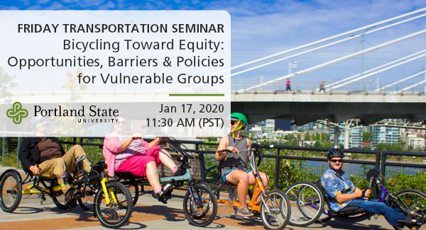
Friday Transportation Seminars at Portland State University have been a tradition since 2000. You can join us in person at 11:30 AM, or you can also watch online.
This seminar will include two papers that will be presented earlier in the week at the Annual Meeting of the Transportation Research Board in Washington, DC.
Adaptive Bikeshare: Expanding Bikeshare to People with Disabilities and Older Adults
Bike share systems are expanding efforts to be more equitable and accessible...
Read moreView slides
If you would like to receive continuing education credits such as PDH or CM, please make sure to complete this evaluation form once you've watched the entire video so that we have a record of your attendance.
Watch video.
Oregon, and Portland in particular, is internationally known for its love for bikes. Not only does the region have some of the highest bike ridership in the nation but the Oregon bike manufacturing industry is quickly growing as well. Oregon’s electric bike (e-bike) market is also growing, but little data are available on the potential market and e-bike user behavior and interest.
Only a limited amount of research has explored the potential new market segments for e-bikes and the economic, operational, safety, and transportation issues surrounding e-bikes in the United States. This webinar will present findings from a research project evaluating e-bike use at three Kaiser Permanente employment centers in the Portland region.
The project's primary goal was to test user...
Read moreWatch video
View slides
Summary: Researchers from the transportation, planning and health fields share the common goal of promoting physically active lifestyle. One challenge that researchers often face is the measurement of physical activity, particularly among children. This is because the sporadic nature of children’s physical activity patterns makes it difficult to recall and quantify such activities. Additionally, children’s lower cognitive functioning compared to adults prevents them from accurately recalling their activities. This presentation will describe the design and application of a novel self-report instrument - the Graphs for Recalling Activity Time (GReAT) - for measuring children’s activity time use patterns. The instrument was applied in a study of children’s risk for obesity and diabetes in a predominately Hispanic community in Milwaukee, WI. Time-use data for two weekdays and one weekend day were collected for various physical and sedentary activities. The data was then assessed against measurements of the children’s cardiovascular fitness, weight status and insulin resistance through exploratory analysis and structured equation modeling. Findings on GReAT’s reliability and new evidence on the impacts of time-use in different activities on children’s risk for...
Read moreThe video begins at 0:23.
Abstract: The bike movement in the United States tends to support infrastructural changes to streets. Reshaping the built environment is expected to stimulate behavior changes in road users. At the same time, this approach may overlook the transportation cultures of existing urban communities and raise concerns about displacement and gentrification. Based on ethnographic research and advocacy experiments in Los Angeles, Lugo proposes the concept of "human infrastructure" to describe the ways that social relationships impact how people experience the built environment. By taking both physical and human infrastructure into account, transportation planners and advocates can make social justice a key part of sustainability.