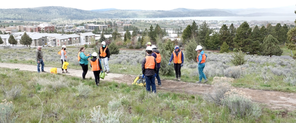
In the latest instance of taking research to practice, researchers at Oregon Tech have completed a pilot section of trail using a NITC-developed sustainable paving method. A quarter-mile section of the Klamath Geo Trail, just east and up the hill from the Oregon Tech Klamath Falls campus, has been successfully resurfaced using volcanic ash from Mount Mazama. Learn more in a free webinar on February 23, 2023: Applying a Mt. Mazama Volcanic Ash Treatment as a Trail Accessibility Improvement.

The researchers explain and demonstrate the process in this NITC research video:

Applying a Mt. Mazama Volcanic Ash Treatment as a Trail Accessibility Improvement

Read more

The Transportation Undergraduate Research Fellowship (TURF) program at Portland State University has hosted twenty-four fellows since 2017, and recently wrapped up its summer 2022 session. This year, six undergraduate researchers worked on projects aimed at improving the safety and efficiency of multimodal transportation systems. The research goals ranged from surveying pedestrian count programs and safety performance functions across the country, to reviewing case studies of tactical curb extensions and collecting pedestrian data at intersections. 

Hosted by PSU’s Transportation Research and Education Center (TREC), the TURF fellows also experience a variety of workshops with PSU faculty and staff on research, communication and data science skills. They attended the 2022 Forth Mobility Roadmap Conference in June, and participated in networking events with the Portland chapters of YPT and WTS. Here is some of what the students had to say about the experience:

"I enjoyed all of the experiences surrounding my time here at TREC, but I loved the workshops. I especially enjoyed Dr. Golub's workshop...

Read more

Transportation can have a significant impact on vulnerable ecologies, especially in rapidly urbanizing regions such as Dallas/Fort Worth. In order for future professionals to balance the needs of sensitive environments with the mobility of people and goods, they must have the proper tools – among other things, a good grounding in regional mapping technologies.

To introduce high school students to geographic information systems (GIS) and spatial reasoning skills, researchers at the University of Texas at Arlington (UTA) developed a four-week training workshop in ArcGIS and other emerging regional mapping technologies. The workshop was incorporated into an existing high school course focused on the transportation network and environmental justice issues in the communities along the Trinity River. 

Led by the research team from UTA's College of Architecture, Planning and Public Affairs (Joowon Im, Assistant Professor of Landscape Architecture, Alan Klein, Director at Institute of Urban Studies, Amruta Sakalker, Graduate Assistant in Planning), they partnered with CityLab High School in the Dallas Independent School District to pilot this workshop. The curriculum, which can be replicated for use by other teachers, introduces students...

Read more