The video begins at 19:28.
View slides
The video begins at 9:39.
I-5 is the only continuous north/south interstate highway on the West Coast, providing a commerce link for the United States, Canada, and Mexico. In the Vancouver-Portland region, I-5 is one of two major highways that provide interstate connectivity and mobility. Operation of the I-5 crossing over the Columbia River is directly influenced by the 5-mile segment of I-5 between SR 500 in Vancouver and Columbia Boulevard in Portland. This segment includes interchanges with three state highways (SR 14, SR 500, and SR 501) and five major arterial roadways that serve a variety of land uses, and provides access to downtown Vancouver, two international ports, industrial centers, residential neighborhoods, retail centers, and recreational areas.
The existing I-5 crossing of the Columbia River consists of two side-by-side bridges, built four decades apart. The crossing, which served 30,000 vehicles per day in the 1960s, now carries more than 130,000 automobiles, buses, and trucks each weekday. The bridges are stretched far beyond capacity—the hours of stop-and-go traffic grow every year. As the metropolitan region grows, mobility and accessibility for automobile, vehicular freight, and transit will decline...
Read morePRESENTATION ARCHIVE
OVERVIEW
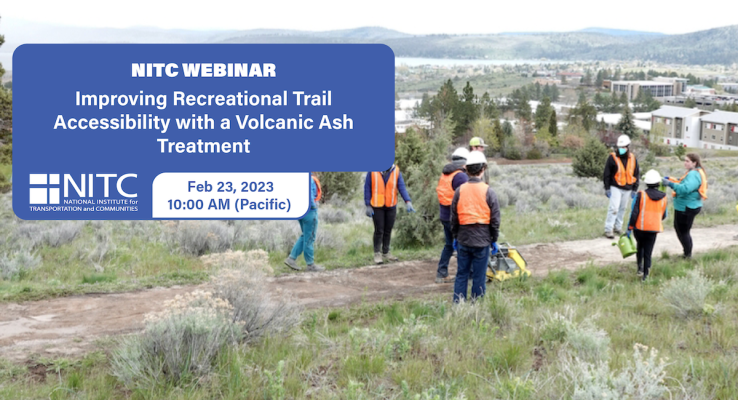
Recreational trails serve as valuable transportation corridors and support the health of users. Wheelchair accessibility of recreational trails depends on a variety of conditions, including slope, cross-slope, and surface characteristics. This project focused on improving the firmness and stability of a 0.2-mile section of trail that was otherwise accessible. The existing trail surface consisted of loose ¼” off-specification aggregate on native soil. A volcanic ash-Portland cement binder, studied in prior research, was batched, distributed, mixed, wetted, and compacted on site to improve the firmness and stability of the surface resulting in a smoother surface with less rolling resistance. The webinar will present details of the trail conditions, materials, batching, placement, and surface characteristics before and after treatment.
KEY LEARNING OUTCOMES
Attendees will be able to:
- Describe and differentiate pozzolanic and cementitious...
The video begins at 12:44.
Abstract: Average Portland rainfall is nearly 37 inches a year. This rainfall usually runs off streets and other impervious surfaces such as roofs and into the sewer system, but this can cause two major problems. First, disposing of runoff in a storm sewer that drains to a river or stream sends dirt, metals, oil, pesticides, and other pollutants right into the water. Second, in neighborhoods with combined sewers, (that is, sewage systems that combine household sewage with the runoff waters from rain), after a heavy rainfall, the high volume of sewage sent to be treated can overwhelm the treatment center and lead to raw sewage discharges into the Willamette River. About 27% of the city is covered by buildings, streets, sidewalks, and other hard, or impervious, surfaces. Paved streets cover about 19% of Portland’s land area, but those streets account for nearly half of Portland’s impervious surfaces. Paved streets contribute 66% of the total annual stormwater runoff and 77% of the pollutants in the runoff. To address this problem, the City of Portland has begun investing in ways to treat stormwater runoff before it enters the sewer system. The city has built and is developing a number of “green street” projects that mimic what happens to rain when it falls on undeveloped areas. A green street uses landscaped curb extensions, lowered infiltration planters and basins, swales, trees,...
Read morePages
- « first
- ‹ previous
- 1
- 2
- 3
- 4