
Watch video
View slides
Summary: Although the running of red lights is perceived by motorists as a commonplace behavior for cyclists, little research has been done on the actual rates of cyclist compliance at signalized intersections. Furthermore, little is known about the factors that influence cyclist non-compliance. This research seeks to illuminate the rates of and reasons for infringement against red lights using video footage and survey data from cyclists in Oregon.
Bio: Sam became interested in transportation and planning while studying abroad in Freiburg im Breisgau, Germany. After benefiting from the efficient transit service and excellent walkability there, he came back to the states with a gusto for safe, efficient, and environmentally sustainable transportation. After finally figuring out what to do with his Civil Engineering degree, he enrolled in Portland State. Sam's research interests include cyclist behavior and the comprehension and safety implications of new infrastructure. Originally hailing from Kansas, he has grown weary of Wizard of Oz jokes but is otherwise happy to call Portland his home, especially with the abundance of good coffee, micro brews, and stellar pie that PDX has to offer.
View Hilltop Planning Group's Slides
View Delta Planning Group's Slides
Watch video:
The PSU Master of Urban and Regional Planning (MURP) program is known for its workshop projects. For the last two quarters of the program, students work on community-based, client-focused projects. This provides students with the opportunity to work in teams on real-world...
Read more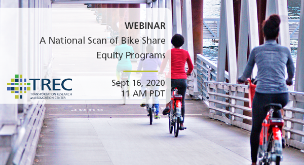
PRESENTATION ARCHIVE
OVERVIEW
Connecting with cities and bike share operators from across the United States, Portland State University conducted a nationwide scan on what programs and initiatives were running to address equity in bike share. The report “National Scan of Bike Share Equity Programs” documents responses from over 70 bike share systems. This resource will help cities and operators navigate the range of actions that have been implemented to make bike share systems more equitable, examine successful strategies employed across the U.S., and understand how those successes (and challenges) are being measured and articulated. In doing so, we hope the report helps bike share systems learn from the experiences of others, innovate, and more quickly move toward greater equity. The research team will be joined by a bike share operator to discuss what they learned, best practices, and where they see the future of bike share equity programs headed.
THE RESEARCH
This webinar is based on a study funded by the Better Bike Share Partnership and the National Institute for Transportation and Communities (NITC) and conducted at...
Read more
EDUCATION LIBRARY ARCHIVE
Missed the webinar or want a look back?
OVERVIEW
There is nationwide interest in supporting sustainable and active transportation modes such as bicycling and walking due to the many benefits associated with them, including reduced congestion, lower emissions and improved health. Although the number of bicyclists is increasing, safety remains a top concern. In urban areas, a common crash type involving bicycles at intersections is the “right hook” where a right-turning vehicle collides with a through bicyclist. While geometric treatments and pavement markings have been studied, there is a lack of research on signal timing treatments to address right-hook bicycle-vehicle conflicts.
Addressing Bicycle-Vehicle Conflicts with Alternate Signal Control Strategies, published in April 2018, is the first study to explore bicycle signal control strategies for addressing bicycle-vehicle conflicts. This study analyzed the operational impacts of traditional...
The video begins at 0:20.
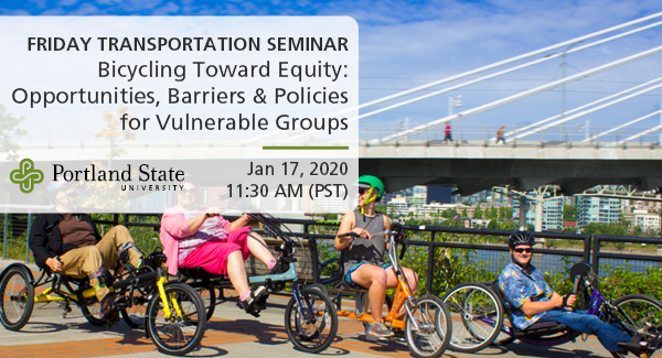
Topic: Inaccessible Accessibility: low-income households and barriers to the “new American dream”
In many ways, the resurgence in demand for housing in highly accessible and walkable neighborhoods can be viewed as a triumph of planning and policy efforts to reinvest in walkable urban neighborhoods that support active travel. However, increased demand has resulted in price premiums that can make location-efficient housing choices more difficult for low-income households. This research uses data from a survey of recent movers in six U.S. cities, including Portland, to explore the extent to which households of different economic means are able to choose housing locations that match their accessibility and transportation preferences.
Bio: Arlie Adkins is a PhD candidate and adjunct instructor in the Toulan School of Urban Studies and Planning at Portland State University. His dissertation research focuses on better understanding how people make decisions about non-work travel behavior in the context of a new home. Arlie holds a master’s degree in city planning from UC Berkeley. He previously worked in TriMet’s project planning department as a community affairs specialist and at Flexcar in Washington, DC.
Friday Transportation Seminars at Portland State University have been a tradition since 2000. You can join us in person at 11:30 AM, or you can also watch online.
PRESENTATION ARCHIVE
- View Jennifer Dill's presentation slides (Women of Color on Two Wheels)
- View John MacArthur's presentation slides (Adaptive Bikeshare)
- Watch the video
THE TOPIC
This seminar will include two papers that will be presented earlier in the week at the Annual Meeting of the Transportation Research Board in Washington, DC.
Adaptive Bikeshare: Expanding Bikeshare to People with Disabilities and Older Adults
Bike share systems are expanding efforts to be more equitable and accessible...
Read more